
|
dharmatreez
Dec 16, 2007, 3:37 PM
Post #1 of 41
(23476 views)
Shortcut
Registered: Oct 25, 2005
Posts: 228
|
Hi PA climbers!
I decided to make a quick overview map to help me work on my area maps over the winter. It is a working copy for now, areas that we haven't had a chance to get to could be on the wrong side of a stream, road, etc...
Any feedback would be greatly appreciated and it will edited for accuracy before it is finished in the spring. Current access issues would certainly be appreciated.
I had to downgrade/size to fit the upload limits on RC, just send me an email (yellowgekohikes@yahoo.com) and I will send you whatever file size you would like.
other sizes available...
Original - 36" x 62" (4.69mb) - how big is your printer...?
Gear Room Wall - 28" x48" (2.91mb)
Travel Map - 21" x 36" (1.68mb) - smallest readable size with good resolution

Long Happy Trails and Safe Climbing,
Jae
(This post was edited by dharmatreez on Jun 4, 2009, 4:08 PM)
|
|
|
|
|
kyote321
Dec 16, 2007, 4:26 PM
Post #2 of 41
(23454 views)
Shortcut
Registered: Apr 24, 2005
Posts: 636
|
Wow! great work. it is cool to see how the areas go with the Appalachian's contours.
|
|
|
|
|
crimpstrength
Dec 16, 2007, 5:16 PM
Post #3 of 41
(23424 views)
Shortcut
Registered: Nov 10, 2004
Posts: 285
|
Really nice job.
Not to be rude but I would have Tilbury as yellow - the houses on either side of the trail to lower tilbury are very friendly but the folks in the house across the street can be moody. What has worked for me: approaching the landowners, introducing myself, being friendly, telling them I appreciate the use of the "beautiful natural area," and thanking them for allowing me to park.
Basecamp PSU? Are you in state college? Are you involved with Outing Club, if so we probably know each other.
|
|
|
|
|
elwood54
Dec 16, 2007, 6:07 PM
Post #4 of 41
(23406 views)
Shortcut
Registered: Jul 8, 2005
Posts: 101
|
looks great, thanks for your work!
|
|
|
|
|
dharmatreez
Dec 16, 2007, 6:54 PM
Post #5 of 41
(23386 views)
Shortcut
Registered: Oct 25, 2005
Posts: 228
|
thanks for all the compliments
thanks too for the heads up on Tilbury, i was hoping to get some current feedback on such things, certainly not being rude at all
Basecamp PSU is a regional map i'm working on that will include all areas within 50 miles of State College
i went to Penn State but was never involved with the Outing Club
be in touch, i'm still "local", just up on the Allegheny Front nortwest of town
safe climbing everyone,
jae
(This post was edited by dharmatreez on Dec 16, 2007, 6:56 PM)
|
|
|
|
|
jt512
Dec 16, 2007, 7:44 PM
Post #6 of 41
(23370 views)
Shortcut
Registered: Apr 12, 2001
Posts: 21904
|
dharmatreez wrote: Hi PA climbers! I decided to make a quick overview map to help me work on my area maps over the winter. It is a working copy for now, areas that we haven't had a chance to get to could be on the wrong side of a stream, road, etc... Any feedback would be greatly appreciated and it will edited for accuracy before it is finished in the spring. Current access issues would certainly be appreciated. I had to downgrade/size to fit the upload limits on RC, just send me an email (yellowgekohikes@yahoo.com) and I will send you whatever file size you would like. other sizes available... Original - 36" x 62" (4.69mb) - how big is your printer...? Gear Room Wall - 28" x48" (2.91mb) Travel Map - 21" x 36" (1.68mb) - smallest readable size with good resolution Long Happy Trails and Safe Climbing, Jae
If any image ever needed to be meatbomzed...
Jay
|
|
|
|
|
dharmatreez
Dec 16, 2007, 9:07 PM
Post #7 of 41
(23346 views)
Shortcut
Registered: Oct 25, 2005
Posts: 228
|
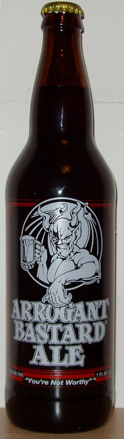
Not sure what a meatbomz is...
but i've been jaebombin' people for years,
BOOM!!

(This post was edited by dharmatreez on Dec 16, 2007, 9:08 PM)
|
|
Attachments:
|
 silverhairedsocalsportardalpha.jpg
(149 KB)
silverhairedsocalsportardalpha.jpg
(149 KB)
|
|
|
|
|
jt512
Dec 16, 2007, 10:25 PM
Post #8 of 41
(23314 views)
Shortcut
Registered: Apr 12, 2001
Posts: 21904
|
dharmatreez wrote: Not sure what a meatbomz is... but i've been jaebombin' people for years, BOOM!!
Pabst???? What's up with that?
How about...
|
|
|
|
|
Valarc
Dec 16, 2007, 11:13 PM
Post #9 of 41
(23303 views)
Shortcut
Registered: Apr 20, 2007
Posts: 1473
|
I personally prefer the Double Bastard, but that's just me...
|
|
|
|
|
gblauer
Moderator
Dec 17, 2007, 12:59 PM
Post #12 of 41
(23226 views)
Shortcut
Registered: Oct 4, 2002
Posts: 2824
|
I think Birdsboro should be "green", the land is owned by the National Lands Trust and they allow rock climbing.
Also, you can add "Swedish Cabin" in Drexel Hill, PA (near PHL). There is a small, accessible ("grren") crag. Good for an afternoon, although the last time we were there, it was filled with trash, broken glass etc.
(This post was edited by gblauer on Dec 17, 2007, 1:02 PM)
|
|
|
|
|
dharmatreez
Dec 17, 2007, 1:14 PM
Post #13 of 41
(23214 views)
Shortcut
Registered: Oct 25, 2005
Posts: 228
|
hi Gail
that is GREAT to hear about Birdsboro being on public land!
it is one of those places i was wishing i could include in my PUBLIC LAND guide.
Thanks!
everyone,
...i'm gathering all this feedback and will post soon (there is alot coming in from emails too)
Thanks again,
Jae
|
|
|
|
|
crimpstrength
Dec 17, 2007, 1:49 PM
Post #14 of 41
(23195 views)
Shortcut
Registered: Nov 10, 2004
Posts: 285
|
Jae,
You deserve all the thanks. That is really great work with the map.
|
|
|
|
|
joeforte
Dec 17, 2007, 2:03 PM
Post #15 of 41
(23189 views)
Shortcut
Registered: May 9, 2005
Posts: 1093
|
That's definately a good start. Some local input should get you some more dots. The northeast is definately lacking a lot of dots, just from a glance, but a lot of the areas are on private land/ abandoned mines.
Two things, first, it's hard to tell the magenta colored dots from the red dots.
Second, Stoney ridge is EAST of the lehigh river. You can put the dot in Bowmanstown, PA.
BTW, I'm the guy that was at the boxcar rocks cleanup with rob. I think we met there right?
|
|
|
|
|
truello
Dec 17, 2007, 2:59 PM
Post #16 of 41
(23164 views)
Shortcut
Registered: Oct 1, 2006
Posts: 737
|
I should've pointed these out earlier but I just noticed now...
Breakneck Rocks should be right where Casparis is now (closer to 119, south of 982).
Casparis should be where Lost Crag is (south Connellsville, north of the Youghiogheny/Railroad tracks).
Lost Crag is almost exactly south of Casparis, approximately 4.5 miles (other side of Yough/railroad tracks).
I am still unsure about Krahlick.
(This post was edited by truello on Dec 17, 2007, 3:04 PM)
|
|
|
|
|
charley
Dec 17, 2007, 8:04 PM
Post #17 of 41
(23095 views)
Shortcut
Registered: Apr 13, 2002
Posts: 6627
|
Krahlic is closed now anyhow.
|
|
|
|
|
dharmatreez
Dec 18, 2007, 3:45 PM
Post #18 of 41
(23042 views)
Shortcut
Registered: Oct 25, 2005
Posts: 228
|
Hi Joe
Nice to hear from you. Yeah that was me swinging the wizzle at Boxcar. Wish I would have had time to climb, still haven't tried out the "pebbles" there.
You guys need anymore help with clean up or trails don't hesitate to be in touch.
Your right at the scale on RC the magenta and red dots are hard to tell apart, it's much better at normal resolution. We're considering different colors and more catagories as well when it is finished up.
It might be usefull to designated the areas only good for bouldering from those with bigger climbs as well.
Thanks for the feedback.
Jae
|
|
|
|
|
dharmatreez
Dec 18, 2007, 3:57 PM
Post #19 of 41
(23034 views)
Shortcut
Registered: Oct 25, 2005
Posts: 228
|
OK, here is the feedback (email, pm, forum) so far:
- Breakneck Rocks - should be where Casparis is...
- Casparis - should be where Lost Crag is (north of tracks)...
- Lost Crag - directly south of Casparis (other side of tracks)
- Haycock - on rt313 between Quakerstown and Doylestown
- Pinnacle - just north of Pulpit (they are 1 mile apart on AT)
- Birdsboro - PUBLIC LAND!!!
- Stoney Ridge - east side of Lehigh River by Bowmanstown
- Chickies - on the east shore
- Rocky Ridge - north of rt30 just below "h" in Hallum
- Safe Harbor - on the east shore
- Tucquan Overhangs - move SW to the "u" on Pequea
I knew there would locations issues, the final copy will have the dots placed by the best GPS coordinates I can find for the areas.
Thanks again for all the feedback (that includes you too Jay - what would we do without you stumbling around drinking your ale, calculator in pocket, and looking for someone to "stick-clip").
Long happy trails and safe climbing,
Jae
(This post was edited by dharmatreez on Dec 18, 2007, 4:00 PM)
|
|
|
|
|
bergman
Dec 19, 2007, 4:08 PM
Post #20 of 41
(22947 views)
Shortcut
Registered: Jun 3, 2003
Posts: 13
|
Great job!
I understand that you've put a lot of work into this, but have you considered using a interactive format (ie., googlemaps) instead of having a jpg as the final result? The JPG looks great as a poster, but it's static and requires a lot of effort to update.
See:
http://maps.google.com/maps/ms?ie=UTF8&hl=en&msa=0&msid=116289982088556420644.000001134e4f0ebd9d478&z=9&om=1
for an example of what's been done with google maps & climbing in PA (it's not my work).
|
|
|
|
|
truello
Dec 19, 2007, 5:49 PM
Post #21 of 41
(22911 views)
Shortcut
Registered: Oct 1, 2006
Posts: 737
|
I think what Jae has now is awesome. I've seen hundreds of Google Maps mashups with climbing spots, and they're great.
But what I like about this is its ability to be printed to hard copy nicely.
|
|
|
|
|
dharmatreez
Dec 19, 2007, 11:56 PM
Post #22 of 41
(22888 views)
Shortcut
Registered: Oct 25, 2005
Posts: 228
|
actually Andy (Truello) has talked to me in past about using similar formats, and i do have that in mind apart from this.
i guess it's my background in art but i prefer hard copies in my hand. there's nothing like spreading out a dozen large maps in front of you on the floor and planning a trip.
this was just a quick copy to put up on my wall for note taking, something to thumbtack, post-it, and mark the 'ish out of, and i thought i would share it in it's rough form
i plan on hand drawing in all the generic logos and vegetation i threw on and possibly using the line the Delaware River makes to draw in a rock wall on the jers' side with a climber on it heading from Philly to NY, so it is more meant to be on a wall when it is finished (well, at least mine...)
but the data could certainly be transferred to an interactive format, that would only really take the raw GPS data, and my list is unfortunately not complete for all of the areas on the map. there might be some that are close already out there.
thanks for the feedback
long happy trails and safe climbing,
jae
|
|
|
|
|
crimpstrength
Feb 14, 2008, 1:49 AM
Post #23 of 41
(22342 views)
Shortcut
Registered: Nov 10, 2004
Posts: 285
|
Ok I know there is probably a better spot for this but I will put it here first.
On your map, you have two areas in Blair County that are shown with decent access - Ganister and Pinnacle. I searched the route database for information on how to get there and found nothing. Any help with these two areas?
Thank you
|
|
|
|
|
dharmatreez
Feb 15, 2008, 12:33 AM
Post #24 of 41
(22300 views)
Shortcut
Registered: Oct 25, 2005
Posts: 228
|
Ganister is quarry walls along the Lower Trail (Rails to Trails) just south of Williamsburg. There are several quarries along the left as you head towards Alexandria. Some are clearly posted and off limits, others are not. All are overgrown and there is alot of loose rock with no real current activity but there are some manky hardware you can see here and there, I've only wandered around while stopped for a break on my bike.
WATCH OUT for copperheads, I've seen a few on the top of the quarries.
Pinnacles is a tower that is right at the edge of the Juniata River north from Williamsburg on the Lower Trail heading towards Canoe Creek State Park. It unfortunately is on the opposite shore from the trail. Might be possible to take an inflatable, it's less than a mile from the Williamsburg trailhead. I rode by it for years wondering if there is any lines up it. Last winter I found out that there is a few lines on it from an old Bellefonte Quarry head. I've just never had the chance to get there since.
Hope that helps, sorry its all observation and no real beta.
Long happy trails and safe climbing,
Jae
|
|
|
|
|
blubeard
Mar 6, 2008, 7:09 PM
Post #25 of 41
(22114 views)
Shortcut
Registered: Jun 21, 2007
Posts: 26
|
First off, nice work. Thanks for distributing it.
Maps are difficult. They are especially difficult if you don't want to be continually updating them. Obviously the GPS coordinates on RC aren't always good or even available, so this type of map is real nice! The problem is that unless you make it modifiable online, it can never be updated by anyone but you. Also, google maps can be easily printed with directions, etc. making them extra useful.
I you want to continue to modify you map, try out his google map, it has some spots you haven't yet added.
http://maps.google.com/...1602&t=p&z=8
|
|
|
|
|
|


